The Tour de Monte Rosa is best approached as an alpine cycling puzzle: valley roads, gravel connectors, and mountain-bike lines that reward flexibility more than raw speed. I would treat it as a scenic, physically honest trip through Val d'Ayas, Gressoney, and Valsesia, with enough variety to suit strong road cyclists, gravel riders, and e-bike travelers. In this guide I break down what the route really covers, which bike setup makes sense, which stages are worth building around, and how to plan the trip without overestimating the mountain.
What matters most before you commit to the ride
- The signature experience is a mixed-terrain Alpine trip, not a single road-only loop.
- A practical day here is often 19 to 51 km (12 to 32 miles), with harder examples rising to about 678 to 1,267 m (2,224 to 4,157 ft).
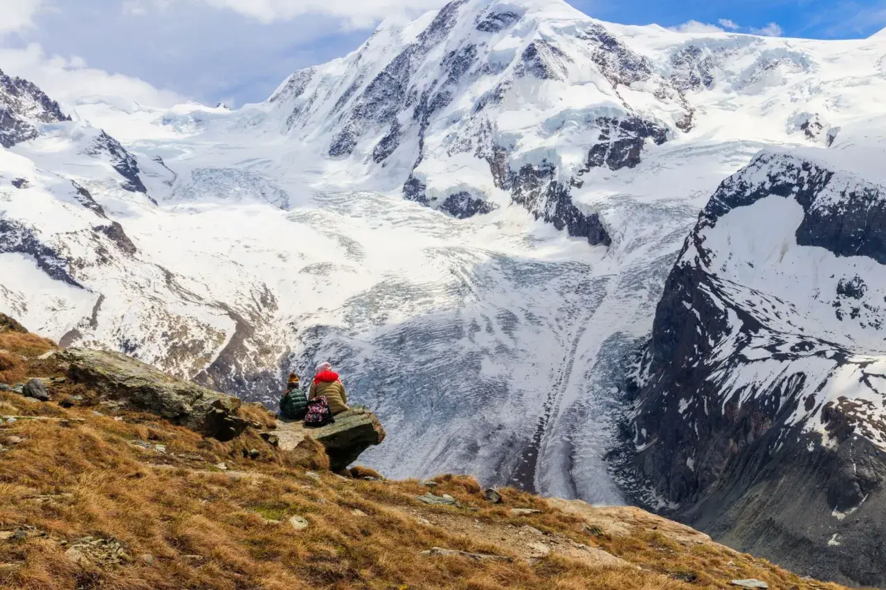
- Val d'Ayas, Gressoney, and Valsesia give the strongest mix of scenery, services, and route variety.
- July and August are the safest months for the highest terrain; June can still hold snow.
- For most travelers, a gravel bike or e-bike is the most forgiving choice.
What the Monte Rosa cycling route really is
I like to be blunt here: this is not a tidy loop that every rider should approach the same way. The area works as a network of panoramic trails linking the main valleys around Monte Rosa, and that is the right mental model. Some days are valley-oriented and steady; others pull you onto steeper connectors, rougher surfaces, or lift-assisted sections.
That variety is the appeal. A strong road cyclist can stitch together passes and valley roads, while a gravel rider gets the best balance of efficiency and texture. If you ride mountain bike, the region feels even more natural, because many of the published itineraries are built around cross-country style routes and scenic backroads rather than pure asphalt mileage.
My own read is that the whole experience works best when you stop thinking in terms of a single finish line and start thinking in terms of daily terrain choices. That leads directly to the most important decision: what bike and what pace make the trip enjoyable rather than merely survivable.
Choose the bike that matches the terrain
If I were planning this from the United States, I would not default to a pure road setup unless I knew I was staying on paved climbs. The mountain rewards the rider who leaves room for mixed surfaces, weather changes, and a little improvisation.
| Setup | Best use | What it feels like | My take |
|---|---|---|---|
| Road bike | Paved climbs and valley links | Fast, efficient, least forgiving on rough connectors | Works if your plan is heavily asphalt-based, but it narrows your options. |
| Gravel bike | Mixed surfaces and day-to-day flexibility | Smooth enough on road, stable on hardpack | The best all-rounder for most independent travelers. |
| MTB | Singletrack, forest tracks, sharper gradients | Slower on the road, happiest off it | The most natural choice for the region's bike itineraries. |
| E-bike | Mixed groups, lower fitness, longer climbs | Lets you save energy for views and descents | The easiest way to turn a hard alpine day into a fun one. |
If you want one answer, I would choose a gravel bike or an e-bike. The gravel bike gives you range without making the descents feel nervous; the e-bike gives you the freedom to say yes to steeper routes and still enjoy the day. Road bikes are fine, but they make more sense only when your plan is heavily paved. The next step is choosing which rides actually deserve a place on the itinerary.
The routes that make the strongest day rides
I would build the trip around a few proven routes instead of trying to do everything. The table below gives you the most useful building blocks in the Monte Rosa area, with the distances translated for US readers.
| Route | Length | Difficulty | Why I would use it |
|---|---|---|---|
| Champoluc to Brusson on the Monterosa Prestige paths | 19.3 km / 12.0 mi | Medium | A very good first day: scenic, accessible, and long enough to feel like a real ride without becoming a grind. |
| Brusson to Saint-Jacques to Antagnod to Brusson | 30.7 km / 19.1 mi | Medium | The balanced option if you want one compact mountain loop with enough climbing to earn the views. |
| Col de Joux circuit | 45 km / 28.0 mi | Medium-difficult | A proper full-day structure for riders who want steady effort, not just a short scenic spin. |
| Saint-Vincent to Col de Joux to Verrès to Saint-Vincent | 51 km / 31.7 mi | Medium-difficult | The longest of the common day-ride styles here, and a good endurance test if you are already fit. |
| Balmuccia to Alagna cycle path | 40.2 km / 25.0 mi, 678 m / 2,224 ft | Difficult | A valley ride that still feels serious; this is the sort of route that rewards a steady pace and a good fueling plan. |
| Issogne round trip | 39.8 km / 24.7 mi, 1,079 m / 3,538 ft | Difficult | Best for riders who want a more demanding mountain-bike day and do not mind paying for the views with climbing. |
| Issogne to Col d'Arlaz and back | 41.3 km / 25.7 mi, 1,267 m / 4,157 ft | Difficult | The hardest example in this set, and the one I would keep for strong riders or e-bikes. |
The point is not that every one of these routes is mandatory. The point is that the region gives you a ladder of difficulty, from a 19 km warm-up to 50 km-plus days that still keep the scenery front and center. I would pick one shorter valley day, one medium climbing day, and one longer ride, because that rhythm keeps the trip interesting. If you want a high-altitude connector, treat it as an exploratory day rather than a beginner-friendly outing.
When to go and how the mountain season changes the ride
Season matters more here than it does on a standard European cycling holiday. Snow lingers at altitude, afternoon weather can shift quickly, and not every service runs on the same calendar. In practice, I see the riding window as late May through September, with the best balance usually landing in July and August.| Time of year | What to expect | My take |
|---|---|---|
| Late May to June | Cool mornings, lingering snow at higher elevations, fewer open services | Good for lower valleys and e-bike touring, not for ambitious high passes. |
| July to August | Most stable weather, long daylight, fuller summer operations | The best overall window for first-timers and multi-day tours. |
| September | Quieter roads, crisp air, shorter days | Excellent if you start early and pack layers. |
In the 2026 summer schedule, lift service begins on May 30 in several bases, which makes lift-assisted MTB days realistic early in the season. I would still check the daily timetable the night before, because the exact operating windows differ by valley and can matter more than people expect.
Timing the trip well saves more energy than any gear upgrade, which is why the pack list matters next.
What to pack, and what usually goes wrong
The mountain punishes small oversights. I would pack for longer descents, quick weather changes, and the reality that a scenic day can become a long day if you miss a junction or pick the wrong tire setup.
What I would never leave behind
- Helmet and gloves - obvious, but long descents make both matter more than on flat tours.
- Wind shell and compact rain layer - weather flips fast above the valley floor.
- 1.5 to 2 liters of water - enough for an alpine half-day without constant stops.
- Tubeless plugs, spare tube, mini-pump or CO2, and a quick-link - small problems become long walks if you skip these.
- Offline maps and a power bank - signal is inconsistent once you leave the towns.
- Cash and a snack reserve - mountain stops are not always set up for card-only riders.
- Extra brake pads - worth carrying on a trip with repeated descents.
Read Also: England Bike Tours - Plan Your Perfect Cycling Holiday
The mistakes I see most often
- Starting too late and finishing in heat or storm risk.
- Assuming a road bike handles every connector comfortably.
- Underestimating brake wear on long descents.
- Planning a route with no bailout or easier alternative.
- Counting on every lift or rental to match a personal schedule.
The hidden trap is not usually the climb itself. It is the combination of fatigue, heat, and a descent that arrives after you have already spent your best legs. That is why I like a route plan with built-in flexibility: one easier option, one harder option, and at least one day that can be shortened without ruining the trip.
How I would put the trip together
If I were building this for a first-time visitor from the U.S., I would keep the logistics simple: choose one base valley, one support strategy, and one weather buffer. Moving hotels every night is possible, but it often costs more energy than it adds value.
- Choose a base in Champoluc or Brusson for Val d'Ayas, Gressoney-Saint-Jean or Gressoney-La-Trinité for the Lys Valley, or Alagna for Valsesia.
- Decide your daily target up front: 19 to 30 km (12 to 19 miles) for a lighter day, 40 to 51 km (25 to 32 miles) for a full alpine day.
- Pick whether you want lift help, self-powered days, or a mix of both.
- Reserve rental or guided support if you do not want to carry your own bike.
- Leave one spare half-day for weather or recovery.
That structure is simple, but it works. It gives you the views Monte Rosa is known for, enough climbing to make the trip memorable, and just enough breathing room to absorb the terrain instead of fighting it. If I had to reduce the whole experience to one recommendation, it would be this: keep the plan flexible and the bike choice forgiving, and the rest of the trip falls into place.