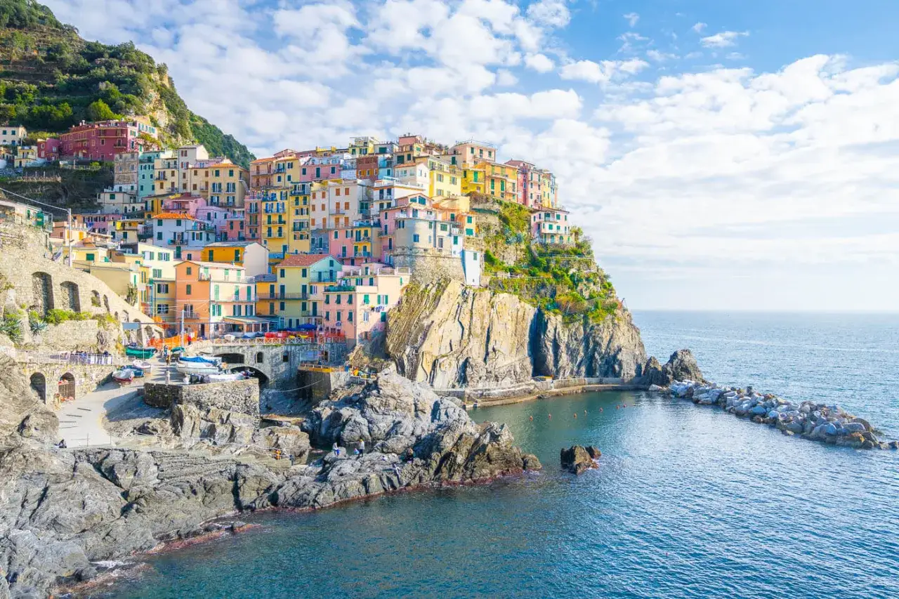
The Cinque Terre rewards hikers who are willing to trade easy mileage for steep stone steps, cliffside exposure, and a lot of payoff per kilometer. Cinque Terre hiking works best when you choose the right segment, the right time of day, and the right fallback plan, because the trail system is beautiful but not forgiving of sloppy planning. This guide focuses on the routes that matter, what the current access rules mean in 2026, and how to build a day that feels like a hike rather than a logistics problem.
What matters most before you set out
- The classic coastal walks are short, but steep and uneven, so distance alone is a poor way to judge them.
- Monterosso to Vernazza is the best first real hike if you want one strong scenic payoff.
- The Via dell'Amore is open as a regulated, booked walk, not as an unplanned stroll.
- Trail status can change quickly after rain or crowd-control decisions, so check live access the same day.
- A train is part of the hiking strategy here, not a backup failure.
Why the trail network feels bigger than it looks
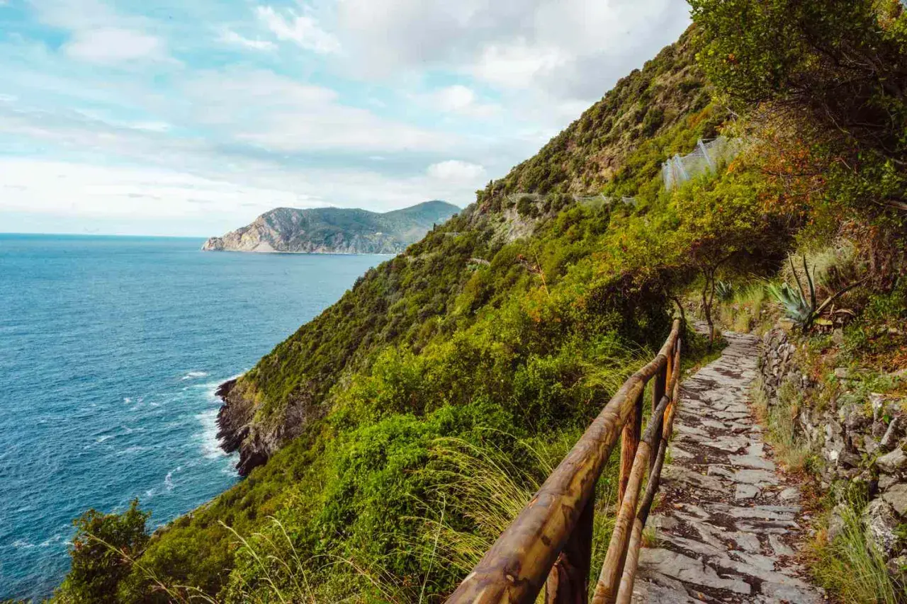
The Cinque Terre trail system is not one long path so much as a connected web of cliffside walks, village links, and inland ridgeline routes. The coastal spine is usually called the Blue Trail, or Sentiero Azzurro, and it is the route most visitors imagine when they think about walking between the five villages. In practice, though, the experience is shaped by elevation more than distance: a 3-kilometer walk can feel serious if it is all steps, loose stone, and exposed slopes.
That is why I think of the area as a set of decisions rather than a single hike. Do you want a short scenic walk with controls and reservations, or a proper half-day effort with real climbs? Do you want the most famous segment, or the one that feels better under your feet? Once you see the network that way, the route choice becomes much easier, and the first good choice is usually the route itself.
The routes I would choose first
If I had to narrow the area down to the walks that are most worth a visitor's time, these are the ones I would put at the top of the list. The table below is the fastest way to compare them without getting lost in the marketing around the villages.
| Route | Distance and time | Difficulty | Why it matters | Current note |
|---|---|---|---|---|
| Via dell'Amore, Riomaggiore to Manarola | About 0.9 km, around 30 minutes | Easy walk, tightly managed | The most famous short walk, with the least physical effort | Reservation required, one-way, and entry is capped in 30-minute slots |
| Monterosso to Vernazza | About 3.7 km, around 2 hours | EE, for experienced hikers | The best balance of challenge, scenery, and classic Cinque Terre feel | Can be subject to one-way flow on busy dates |
| Vernazza to Corniglia | About 4.1 km, around 1 hour 30 minutes | EE, for experienced hikers | Slightly longer, still dramatic, and often a touch less crowded | Check the live status before you commit |
| Manarola to Corniglia via Volastra | About 5.5 km, around 2 hours 30 minutes | Moderate to challenging | The smartest fallback when the short coastal link is closed | Useful when the direct route is shut or when you want a more varied inland walk |
| Riomaggiore to Manarola via Beccara | About 1.5 km, around 1 hour | EE, for experienced hikers | The steep alternative if you want effort between the two southern villages | Better for hikers than for casual strollers |
At the moment, the short Manarola to Corniglia coastal segment is the one I would treat as variable, because the park's live status pages currently list it as closed and direct hikers toward the Volastra alternative. That matters because this is exactly the kind of detour that can turn a rushed day into a good one, if you plan for it in advance. The routes are close enough to compare on paper, but what matters on the ground is how much climbing and rerouting you are willing to absorb.
How hard the hikes feel in real life
The official difficulty labels are useful, but they are not the whole story. In the Cinque Terre, the word "moderate" can still mean narrow footing, repeated climbs, and descents that hit your knees harder than you expect. I would read the trail grades this way: E means hiking terrain, while EE means the route is better suited to people who are already comfortable with steep ground, uneven surfaces, and route-finding under pressure.
- Steepness beats distance. Many of these walks are short enough to underestimate, but the effort comes from the profile, not the kilometer count.
- Downhill can be the trap. Long descents into a village often feel more punishing than the climb out, especially if the ground is loose or dusty.
- Heat changes everything. In summer, a route that feels manageable in the morning can feel much harder by early afternoon.
- Footing is uneven. Expect stone, dust, and occasional slick sections after rain.
- Poles help, but they do not fix poor pacing. They are useful on climbs and descents, yet they will not make a badly timed start feel good.
This is also why I would not recommend treating the area like a promenade walk unless you are on the shortest regulated section. If you are not used to stair-heavy hiking, start with one route, not three. The next question then becomes less about fitness in the abstract and more about access, fees, and how the park controls the busiest parts of the system.
Tickets, access, and the rules that actually shape the day
The National Park's card system is not just a ticketing device, it is part of the hiking experience. In current 2026 pricing, the Trekking Card starts at €10 for one day in low season and €15 in high season, while the 2-day option starts at €17 and rises to €26.70 in high season. The Train Card starts at about €17.30 for one day in the latest band I checked, with higher rates on busier dates. The card is personal and non-transferable, and digital use is accepted.
| Access item | What it covers | Practical meaning |
|---|---|---|
| Trekking Card | Access to the regulated coastal trail system and selected park services | Best if you are walking and using the local buses, but not relying on the train all day |
| Train Card | Trail access plus regional train travel between the villages | Best if you want to combine hiking with village hopping and flexible exits |
| Via dell'Amore access | Reserved entry with a 30-minute time slot and a one-way flow from Riomaggiore to Manarola | Good for the iconic short walk, but it must be booked and capped at 200 people per slot |
| Live status check | Current closures, one-way systems, and weather-related restrictions | Essential on the day, because trail conditions can change faster than your itinerary |
There is one more detail that catches people out: the regulated access model is only part of the picture. The park is trying to protect fragile terrain while handling heavy demand, so the smartest plan is to treat tickets, reservations, and live status as part of the hike itself. If that sounds bureaucratic, it is, but it is also the reason the most famous routes are still walkable instead of being overwhelmed.
When to go and how to dodge the worst crowds
The best walking windows are still the shoulder seasons, especially late March to June and then September into mid-October. Those periods give you a better balance of temperature, daylight, and crowd pressure. July and August are the hardest months, not because the trails stop being beautiful, but because heat, humidity, and bottlenecks can drain the joy out of even a short route.
- Start early. The first trains of the day are often the most useful for hikers who want quieter paths.
- Watch the weather. Rain matters here because a single wet spell can lead to closures or reroutes.
- Expect crowd controls. The park sometimes uses one-way flow on the busiest coastal section when demand spikes.
- Do not force the original plan. If a section is closed, the smartest move is usually a detour or a train hop, not a workaround.
That timing advice sounds simple, but it changes the whole experience. A morning start can make a hard route feel pleasantly demanding, while a late start can turn the same walk into a grind. From there, the final step is turning all of this into a route plan that actually fits a real traveler's day.
How I would plan a first day on the trails
If I were building a first visit from scratch, I would keep the plan deliberately simple. The area rewards restraint far more than over-scheduling, and the train makes it easy to protect the parts of the day that matter most.
- For one good classic hike: Start in Monterosso, walk to Vernazza early, then decide there whether you have the legs for Corniglia. If you do continue, fine, but I would not promise myself the extra mileage before I start. That keeps the best climb of the day from feeling like a box to check.
- For a lighter scenic day: Book the Via dell'Amore, then use village time and train hops to fill the rest of the day. This is the better choice if you care more about atmosphere and photos than about earning elevation.
- For a two-day plan: Split the classic coastal section into two separate outings, then use the second day for the Volastra side if the shorter Manarola to Corniglia link is closed. That gives you variety without forcing long back-to-back climbs.
Corniglia deserves a special mention here because it sits high above its station. If you finish there, leave time for the stairs or the shuttle, otherwise the day ends with more climbing than you budgeted for. That is the kind of detail that makes the difference between a smooth day and a frustrating one.
Why the best Cinque Terre day is never fully packed
The temptation in this region is to try to maximize every village and every viewpoint, but the better approach is to leave one slot open. I would rather build in 45 minutes of slack than squeeze in one extra segment and end up rushing the last climb, missing lunch, or arriving at the station just as my body wants to stop. The trails are rewarding enough that you do not need to optimize them aggressively.
- Bring more water than you think you need for the first half of the day, because exposed climbs dry you out faster than the map suggests.
- Wear shoes with real grip. Smooth sneakers are the wrong tool here.
- Use the train as a tactical shortcut, not as a sign that the day failed.
- Leave time for village stairs, especially if Corniglia is part of the route.
- Check the live trail status before breakfast, not when you are already standing on the platform.
If I had to reduce the whole area to one practical sentence, it would be this: choose one demanding segment, keep one flexible, and let the rest of the day breathe. That is the version of hiking in the Cinque Terre that gives you the views, the effort, and the freedom to adapt when the coast does what it often does best.