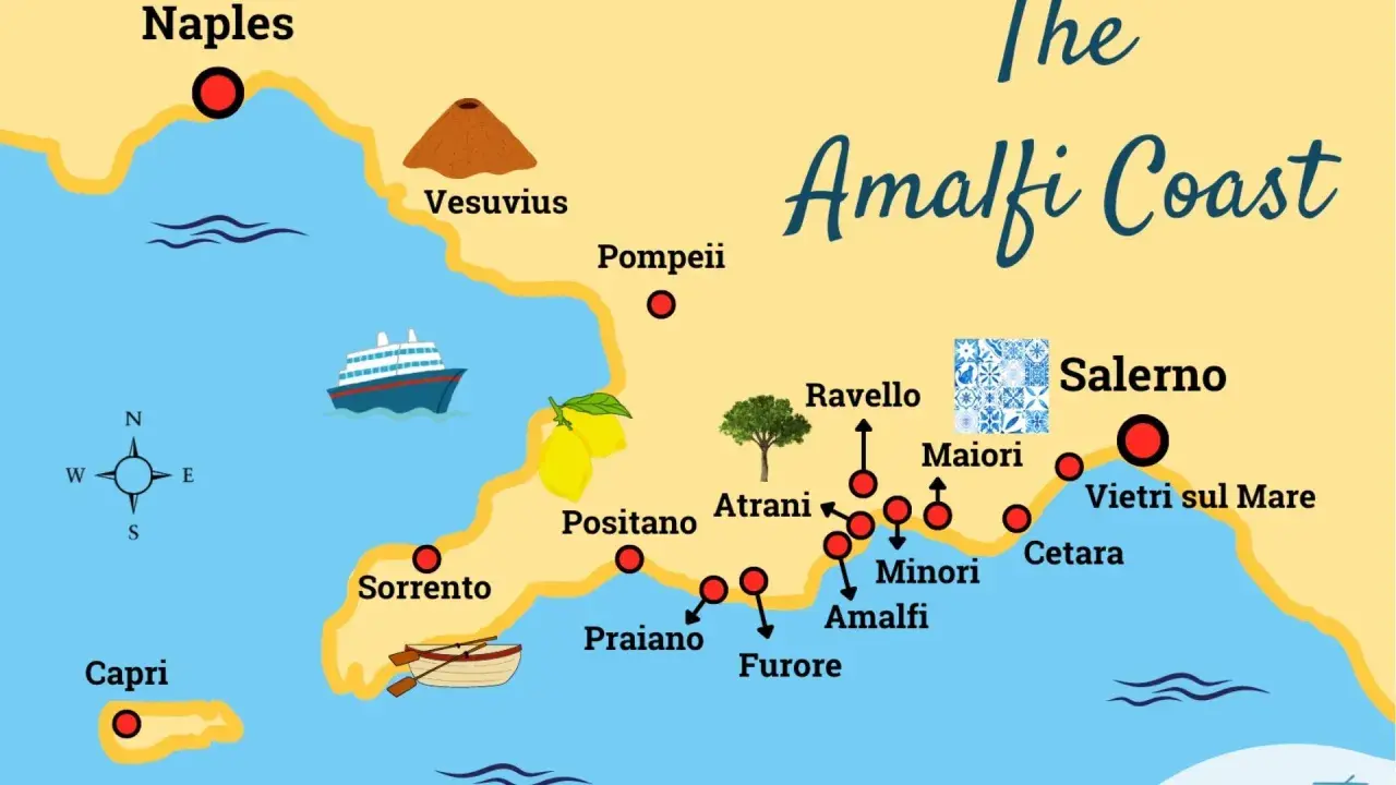
An Atrani Italy map is most useful when you need to see how the village fits into an Amalfi Coast itinerary, not just where it sits on the shoreline. Atrani is tiny, tucked below steep hills, and connected to Amalfi in a way that looks simple on paper but changes the whole trip once you arrive with luggage, a timetable, or a dinner reservation. I focus here on the details that actually help with planning: where it sits, how to reach it, what the walk feels like, and how to decide whether it should be your base or a stop.
The few facts that shape every Atrani visit
- Atrani sits directly next to Amalfi on the Amalfi Coast, so most visitors use Amalfi as the reference point.
- The village is compact but vertical, which means short distances on a map can still involve stairs and slopes.
- The easiest public-transport pattern is usually train to Salerno, then ferry or bus to Amalfi, followed by a short walk.
- Ferries commonly stop in Amalfi rather than Atrani itself, so the last leg is often on foot.
- Atrani works best for travelers who want a quiet, walkable base rather than a road-trip style stop.
What the village map tells you at a glance
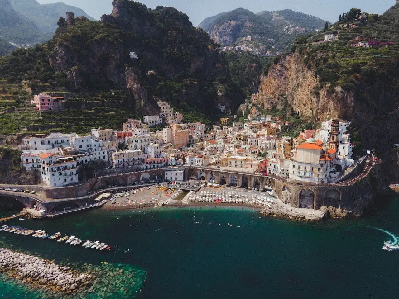
When I look at the layout of Atrani, I see a village that is more about position than size. It sits immediately next to Amalfi, pressed between the sea and steep hills, with the beach at the lower edge and the historic streets climbing upward from there. That is why a map matters so much here: the town is small enough to cross quickly, but its shape affects how easy it is to arrive, unload bags, and move around once you are there.
A good mental map of Atrani should answer four questions before you book anything else:
| On the map | What it means in practice |
|---|---|
| Right next to Amalfi | Amalfi is the easiest landmark and the main transfer point for most trips. |
| Narrow coastal pocket | Space is tight, so parking, drop-offs, and turning around by car are not effortless. |
| Beach at the base, homes above | Distances are short, but elevation can make them feel longer than they look. |
| Set under steep hills | Expect stairs, ramps, and some route changes that do not show up on a simple line map. |
I think of Atrani as a place where the map is accurate in distance but incomplete in effort. The village is close to everything you care about, yet the terrain adds a layer of planning that first-time visitors often underestimate. That distinction matters because it changes how you choose your arrival point, which is where the logistics start to matter.
How to reach Atrani without overcomplicating the route
The cleanest way to reach Atrani is usually to treat Amalfi as the arrival hub and Atrani as the final short walk. There is no train line running through the coastal towns, so rail travelers generally use Salerno as the practical gateway, then continue by ferry or bus. If you are coming from Naples, Sorrento, or Rome, the key is not to chase the shortest line on a map, but to choose the connection that gives you the fewest awkward transfers.
Here is the simplest way I would break down the options:
| Arrival method | Best for | Main advantage | Main tradeoff |
|---|---|---|---|
| Train to Salerno, then ferry or bus to Amalfi | Most public-transport travelers | Reliable rail access and a straightforward coast connection | One transfer is unavoidable |
| Ferry to Amalfi | Travelers who want the scenic approach | Usually the easiest way to avoid coastal road traffic | Schedules vary seasonally and services do not always run late |
| Private transfer or taxi | Families, late arrivals, heavy luggage | Least stressful door-to-door option | Most expensive choice |
| Driving yourself | Only if you already know your parking plan | Flexibility for wider Amalfi Coast trips | Parking is limited and the roads are not forgiving |
The detail that matters most is the last leg. Ferries usually land in Amalfi, not directly in Atrani, and from there it is often a five- to ten-minute walk depending on pace, route, and luggage. That walk is short, but it is also the reason Atrani feels different from larger coastal towns: once you know the connection, the village stops being a mystery and starts being a practical base.
Why the short walk from Amalfi changes the plan
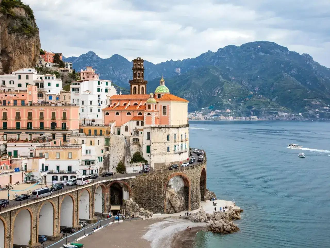
On paper, Amalfi and Atrani look almost merged, and in real life they are close enough that you can easily combine them in a single afternoon. What the map does not show clearly is how much the topography shapes the experience. A walk that looks trivial becomes more interesting when you factor in narrow sidewalks, stairs, tunnels, and the fact that you may be moving with a day bag, beach gear, or a suitcase.
That is why I would not judge Atrani only by distance. I would judge it by walkability. If your trip is built around slow mornings, beach time, and dinner out without moving the car again, Atrani works extremely well. If you want easy vehicle access, large hotel lobbies, and a flat road layout, it is a less natural fit.
- Best for slow travelers: you can settle in and move around on foot most of the day.
- Best for photographers: the compact layout gives you quick access to beach, alleys, and coastal views.
- Less ideal for mobility limits: stairs and uneven paths are part of the village’s character.
- Less ideal for heavy luggage: a “short” transfer may still feel inconvenient if you arrive late or tired.
I usually tell people to read Atrani as a vertical village rather than a flat beach town. That is the difference between a smooth stay and one that feels unnecessarily complicated, and it also explains why choosing the right base along the coast matters so much.
Where I would stay depending on the kind of trip you want
If the map is driving your decision, the real question is not just where Atrani is, but whether it should be your sleeping base. For a short coastal trip, I would weigh it against Amalfi, Ravello, Minori, and Salerno before I book anything. Each one solves a different problem, and the best choice depends on whether you care more about scenery, transport, quiet, or cost.
| Base | Best for | Why it works | What to watch |
|---|---|---|---|
| Atrani | Quiet, walkable seaside stays | Small scale, easy access to Amalfi on foot, strong sense of place | Limited parking and fewer large hotels |
| Amalfi | First-time visitors and transport-heavy trips | Main hub for ferries, buses, restaurants, and practical services | Busier and usually less intimate than Atrani |
| Ravello | Views, gardens, and a quieter hilltop atmosphere | Great for scenic stays and a slower rhythm | No beach and an extra transfer if you want the water |
| Minori | Longer beach time and a gentler pace | Often feels easier for longer stays and coastal wandering | Less central if you plan to move around a lot |
| Salerno | Rail-based arrivals and lower-friction logistics | Best rail gateway for the coast, useful if you want to minimize transfers | You are not sleeping in the postcard village itself |
For a scenic trip, I would choose Atrani when I want atmosphere and short walks, Amalfi when I want the easiest transport hub, and Salerno when I want the trip to run smoothly from the start. That choice sounds small, but it often decides whether the stay feels effortless or slightly tiring, which leads straight into the mistakes people make when they rely on the map too literally.
Common planning mistakes the map will not warn you about
The map shows location, but it does not show pressure points. These are the errors I see most often when people plan Atrani too quickly:
- Assuming ferries stop everywhere: in practice, many visitors arrive in Amalfi and continue on foot to Atrani.
- Underestimating stairs: a short street view can still involve a climb that feels bigger than the map suggests.
- Booking without checking luggage access: a beautiful room can still be awkward if you need to carry bags up several levels.
- Planning around a car first: parking is limited, and the road layout is not built for relaxed self-drive touring.
- Ignoring seasonal transport changes: boat and bus frequency can change, especially outside peak months.
- Arriving too late in the day: the later you arrive, the less margin you have if a connection slips.
My rule is simple: if a route looks too easy on a screen, I assume there is a missing detail somewhere in the terrain or the timetable. That habit saves time, and it also helps you turn the map into a realistic plan instead of a pretty outline.
A simple way to turn the map into a trip plan
When I build an Atrani itinerary, I keep the structure extremely simple. First, use Salerno or Amalfi as your transport anchor. Second, decide whether Atrani is your overnight base or your scenic stop between bigger names. Third, add Ravello, Minori, or a beach afternoon only after the logistics are settled. That order removes most of the friction before you ever step on the coast.
- Choose Atrani if you want a small, atmospheric base with easy access to Amalfi on foot.
- Choose Amalfi if transport convenience matters more than quiet.
- Choose Salerno if you want the smoothest rail connection into the coast.
The best use of a map here is not navigation for its own sake. It is decision-making: where to sleep, how to arrive, and how much walking you are happy to do after the transfer. If you get those three things right, Atrani becomes one of the easiest small places on the Amalfi Coast to enjoy, and the rest of the trip falls into place naturally.