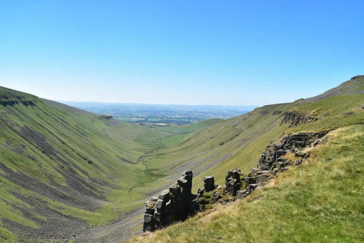
The Pennine Way is one of England’s classic long-distance hikes: a route that feels like a genuine journey rather than a collection of scenic walks. In this guide I focus on the practical side of it - what the trail is really like, how hard it is, when to go, how to split it into sensible stages, and what tends to catch walkers out.
Key things to know before you plan the walk
- The trail runs for 268 miles (431 km) from Edale in Derbyshire to Kirk Yetholm in the Scottish Borders.
- Most full-length walkers allow 16 to 19 days, while a longer 22-day itinerary is also commonly used.
- Mid-May to September is the most reliable weather window, although the route can be walked in other months if you are prepared.
- The terrain changes constantly: Peak District moorland, Yorkshire Dales limestone, North Pennines uplands, Hadrian’s Wall country, and the Cheviots.
- The hardest stretch is usually the remote final run into the Scottish border, where weather and fatigue combine.
- Accommodation exists along the route, but upland sections can be thin on beds, so planning ahead matters.
What this trail really is
The Pennine Way is Britain’s original long-distance trail in the modern sense, and it still feels that way: purposeful, rugged, and unapologetically northern. What makes it special is not just the scenery, but the way the route strings together very different landscapes into one continuous walk. You start in the Peak District, move through the Yorkshire Dales, cross the North Pennines, pass Hadrian’s Wall, and finish on the Scottish border.
I think its appeal comes from that combination of scale and variety. This is not a polished promenade with constant services and gentle gradients. It is a walking route that asks for fitness, patience, and a willingness to deal with wind, wet ground, and the odd day that feels longer than it should. That is exactly why it matters to hikers: it rewards preparation rather than luck. Once you understand that, the next question is not whether it is beautiful, but how demanding it will be for you specifically.
How hard it is in real life
On paper, the trail is a long walk. In practice, it is the weather, the underfoot conditions, and the cumulative fatigue that make it challenging. The route is not a technical mountain expedition, but it does spend a lot of time on exposed moorland where navigation can be slow and visibility can collapse quickly. Wet peat, slick stone steps, and long uphill stretches make the effort feel more serious than the mileage alone suggests.
National Trails says most full-length walkers allow 16 to 19 days, and that feels realistic to me for anyone who wants to enjoy the route rather than merely survive it. If you push harder than that, you need a strong base of hill fitness, efficient packing, and a comfortable pace in bad weather. If you are new to long-distance hiking, the best mindset is simple: treat it as a long mountain walk split into stages, not as a flat-distance challenge with pretty views.
| Way to walk it | Typical commitment | Best for | Main trade-off |
|---|---|---|---|
| Full crossing | 16 to 19 walking days | Experienced long-distance hikers | Requires more logistics and weather tolerance |
| Bookable long itinerary | About 22 days | Walkers who want shorter daily mileage | Needs more holiday time |
| Section walk | 3 to 7 days, or long weekends | First-timers and time-limited travelers | Less sense of a continuous journey |
For timing, I would use the same advice the trail managers give: mid-May to September is the safest window if you want the most reliable conditions. That does not mean the route is impossible outside those months, only that the margin for error gets smaller. Once you accept that the walk is weather-sensitive, the landscape itself becomes the more interesting part of the decision.
The landscapes change more than most people expect
One reason the route stays memorable is that it never settles into a single mood for long. The opening miles out of Edale are steep, high, and exposed, with the Peak District setting an honest tone from the start. You then move into the South Pennines, where the walking can feel raw and open, with peat, reservoirs, and broad moorland instead of tidy paths. Later, the Yorkshire Dales bring a more dramatic limestone character, which is a welcome contrast after all that bog and heather.
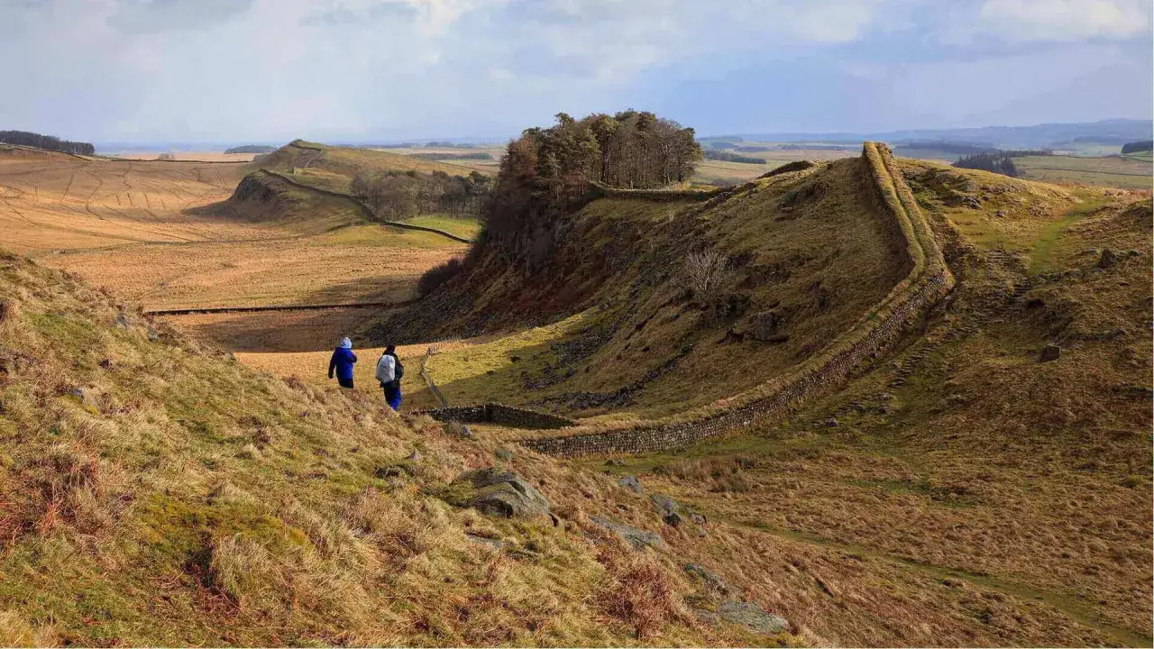
By the time you reach the North Pennines, the trail becomes quieter and more remote. This is where many walkers underestimate the psychological effect of long empty stretches: the scenery is beautiful, but the lack of villages and services means you have to think ahead. Hadrian’s Wall changes the mood again by adding history and structure, and the final Cheviot Hills section gives the route a last burst of wild, border-country energy. If I had to explain the appeal in one sentence, I would say this: the trail keeps resetting itself, so your legs and your attention never get lazy.
| Section | What it feels like | What to watch for |
|---|---|---|
| Peak District | Steep, exposed, and immediately serious | Wind, navigation on the tops, and heavy legs early on |
| South Pennines | Open moorland with reservoirs and gritstone edges | Wet ground, visibility, and longer-than-expected days |
| Yorkshire Dales | More sculpted, with limestone, villages, and classic hill scenery | Stiff climbs and rough descents |
| North Pennines | Remote, quiet, and expansive | Long gaps between services and accommodation |
| Hadrian’s Wall to the border | Historically rich and mentally uplifting | A final long push before the finish |
That changing character is what makes route planning matter. The next decision is how you actually divide those landscapes into days that make sense.
How to plan stages without making the walk harder than it needs to be
I would start with one simple rule: plan around accommodation first, not around an idealized daily mileage. The trail is long enough that a beautiful stage plan can fall apart the moment you discover there are no sensible beds where you wanted to stop. This is especially true on the upland sections, where places to stay can be sparse and you may need to choose between a long day or a night off-route.
For most walkers, a realistic day is somewhere in the 12 to 18 mile range, depending on terrain, weather, and how much climbing sits in that day. That is not a rigid rule. A 12-mile day over wet moorland can feel harder than 18 miles on firmer ground. What matters is the balance between effort and recovery. If you string together too many big days too early, the last third of the route will punish you for it.
National Trails’ route planning tools are useful because they make it easier to see accommodation, services, and transport links together rather than in isolation. That matters on a trail like this, where a “good” itinerary is usually the one that reduces stress, not the one that sounds most heroic. If I were planning from scratch, I would build in at least one flexible buffer day for weather, sore feet, or a delayed arrival at the start.
What I would pack for this trail
The packing list is not glamorous, but this is where many first-time long-distance walkers make avoidable mistakes. You do not need mountain expedition gear, yet you do need kit that handles wind, water, and repeating days outside. The biggest error is overconfidence: people pack for the scenery they hope to get and not for the conditions they are likely to meet.
- Reliable waterproof layers - a proper shell matters more than a “light shower” jacket when the weather turns.
- Footwear you already trust - do not use the trail to break in boots.
- Navigation backup - I would not rely on a phone alone in open moorland.
- Spare socks - small item, big morale difference.
- Layering pieces - a cold ridge can feel very different from a sheltered valley.
- Snacks and a backup meal - services are not evenly spaced.
- Power bank - especially if you are using digital maps and accommodation confirmations.
A few technical terms are worth keeping in mind. “Bog” means soft, waterlogged ground that can slow you down and sap energy. “Waymarking” refers to the trail signs and markers that help confirm you are on the route. “Bothies” are very basic refuge shelters found in some remote areas; they are not a substitute for normal accommodation, but they can matter in an emergency. Once you understand that vocabulary, the route becomes easier to read on the ground.
If you do not want the full crossing, choose your section carefully
Not every walker needs the whole trail, and I would argue that this is one of the route’s strengths. Because it passes through so many distinct landscapes, sectional walking still gives you a genuine experience rather than a watered-down version. The trick is choosing a section that matches the kind of hike you actually want.
If you want the most classic all-round introduction, the Yorkshire Dales sections are hard to beat. They have enough ascent to feel earned, enough villages to make logistics manageable, and enough visual drama to justify the effort. If you want a wilder and quieter feel, the North Pennines are more remote and less crowded. If history matters as much as scenery, the stretch around Hadrian’s Wall delivers a very different kind of satisfaction, because you are walking through a landscape that carries its story with it.
- For first-time long-distance walkers - choose a section with easier access to accommodation and transport.
- For scenery-heavy hiking - prioritise the Dales and the limestone country.
- For solitude and big skies - look toward the North Pennines.
- For history and atmosphere - pick the Wall country and the border approaches.
If I were advising a traveler from the US who wanted one meaningful taste of northern England rather than a full commitment, I would choose a short section with good train or bus access and a clear visual identity. That gives you the essence of the trail without forcing the whole holiday to revolve around logistics.
The decisions that make the trail easier before you book anything
The route becomes much more manageable when you make the right decisions early. Start by deciding whether you want a full crossing, a guided-style itinerary, or a section walk. Then choose your season honestly, based on how much weather uncertainty you are willing to absorb. After that, build the route around beds, transport, and food stops rather than trying to force a perfect mileage pattern.
The other decision that matters more than people expect is pace. A slower schedule is not a compromise on a walk like this; it is often the difference between noticing the landscape and merely enduring it. That is the part of the Pennine Way I respect most. It rewards people who plan well, move steadily, and stay realistic about the ground in front of them. If you do that, the trail gives back far more than distance.