The South West Coast Path is one of the most rewarding long-distance hikes in Britain: 630 miles of cliffs, coves, fishing villages, and hard-earned views from Somerset to Dorset. The route many readers know from the Salt Path is not just a literary reference; it is a real trail that works as a day walk, a week-long section, or a full thru-hike. This guide covers what it is, which stretches are worth prioritizing, when to go, and how to plan it without making the trip more complicated than it needs to be.
The quickest facts you need before setting out
- The trail runs for about 630 miles (1,014 km) from Minehead in Somerset to Poole in Dorset.
- The full route is usually broken into 52 stages, so most walkers experience it in sections rather than as one nonstop trip.
- The most dramatic scenery often comes on the Exmoor, North Devon, and western Cornwall stretches, but the Jurassic Coast is a strong finish.
- May through September is the easiest planning window for most hikers, especially if you want longer daylight and simpler logistics.
- On this trail, weather, steep ascents, ferry links, and accommodation availability matter more than elevation.
What the route actually is
The South West Coast Path is England’s classic National Trail, and I think it works best when you understand it as a chain of distinct coastal walks rather than one single, uniform route. It passes through seven geographic sections: Somerset and Exmoor, North Devon, North Cornwall, West Cornwall, South Cornwall, South Devon, and the Jurassic Coast. That mix is the point. One day you are on open cliff tops with Atlantic wind in your face; another, you are dropping into a harbor village for lunch and climbing back out again.
That variety also means the trail suits different styles of travel. Some people come for a full thru-hike, some choose one region, and others just want a few unforgettable day walks. I usually tell readers that the route rewards flexibility more than brute ambition. If you want to enjoy it, you do not need to walk every mile.
The other thing worth knowing is that the walk is as practical as it is scenic. You will deal with stiles, steep downhills, occasional ferry links, and weather that can change quickly on exposed headlands. None of that makes the trail difficult in a technical sense, but it does make planning matter. That is why the next question is not “Can I walk it?” but “Which version of it fits my time and energy?”
How I would choose a version of the walk
If I were planning a first trip, I would not start by aiming for the entire route. I would start by deciding how much time I actually want to spend walking, then pick the format that makes the trip enjoyable rather than exhausting. A full traverse is a serious commitment; a one-region section gives you most of the scenery with less logistical drag.
| Way to walk it | Typical length | Best for | What it feels like |
|---|---|---|---|
| Full thru-hike | 52 stages, usually well over a month of walking | Experienced long-distance hikers | The most complete version, but also the most demanding to plan and sustain |
| One regional section | 3 to 10 days | Most first-time visitors | Enough time to settle into the rhythm without carrying the full burden of a long expedition |
| Day walks and loops | 5 to 15 miles, depending on the section | Casual hikers, families, and short-break travelers | Simple, flexible, and easy to combine with a base stay or public transport |
For a traveler coming from the U.S., I think the sweet spot is often a five- to seven-day section. It is long enough to feel like a real adventure, but short enough that weather delays, train schedules, and accommodation choices do not dominate the trip. Once you know how you want to walk it, the next step is choosing the stretch that gives you the best payoff.
The stretches I would prioritise first
If you only have time for one part of the route, I would focus on the sections that give you the strongest coastline-to-footpath ratio: Exmoor, North Devon, and western Cornwall. Those stretches deliver the most immediate sense of drama. You still get village life, harbors, and pub stops, but the cliffs and headlands feel like the main event.
| Section | Length | Why it stands out |
|---|---|---|
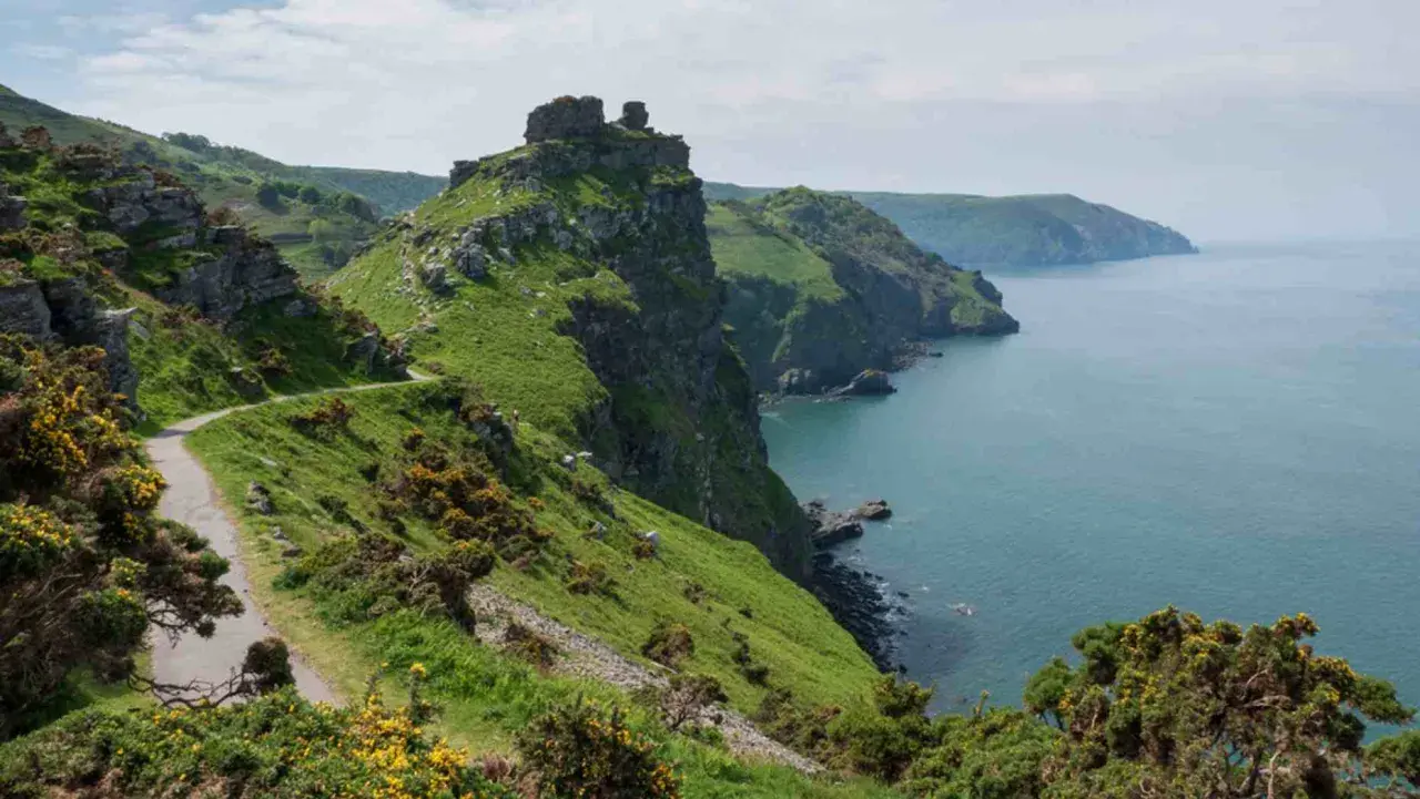
| Somerset and Exmoor | 35 miles | Wild, steep, and atmospheric, with a strong contrast between moorland and sea; Great Hangman rises to 318 meters and gives the area real scale. |
| North Devon | 80 miles | Big cliff walking, remote coves, and a rugged feel that quickly justifies the effort. |
| North Cornwall | 76 miles | Classic surf coast energy, long headlands, and a satisfying mix of open views and beach towns. |
| West Cornwall | 144 miles | The longest section, and often the most memorable for sheer Atlantic exposure and Penwith scenery. |
| South Cornwall | 76 miles | More sheltered in places, with harbors, estuaries, and a gentler pace after the west. |
| South Devon | 104 miles | A more varied feel, with estuary crossings, historic towns, and softer coastal scenery. |
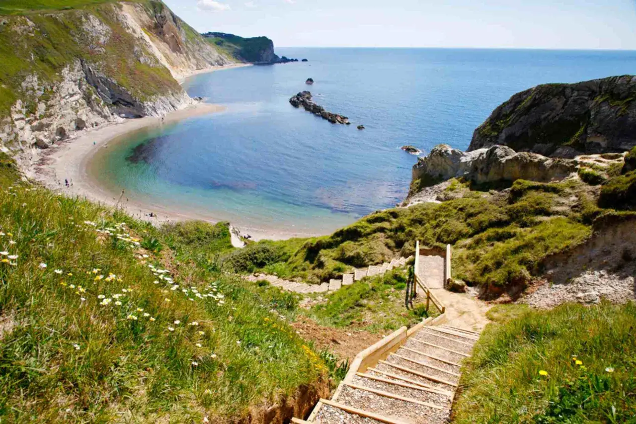
| Jurassic Coast | 115 miles | Geology takes the lead here, with cliffs and formations that feel different from the rest of the trail. |
My honest take: if you want the biggest visual return in the shortest amount of time, start in Exmoor or North Devon. If you want a coast that feels broader and more famous for its light, surf, and granite headlands, head toward Cornwall. Either way, the route is only half the story. Season and logistics decide how pleasant the walk actually feels.
When to go and what can complicate the walk
May through September is the most forgiving window for most walkers. You get longer days, more open accommodation, and a better chance of dry ground underfoot. I would still avoid treating summer as a perfect answer. Late July and August bring higher room rates, busier villages, and less flexibility if you decide to change plans at the last minute.
Shoulder season can be excellent if you want quieter paths, but it comes with trade-offs. Some ferry services run less frequently outside peak months, and a few coastal links are harder to manage when schedules tighten. Winter walking is possible on shorter sections, but I would only recommend it to confident hikers who are comfortable with short daylight hours, wind, and muddy ground.
- Wind and rain can turn easy-looking mileage into a slog, especially on exposed headlands.
- Steep ascents and descents often matter more than distance, so a 10-mile day can feel much longer.
- Tide-sensitive crossings may affect some beach or estuary links, so check conditions before you set out.
- Accommodation gaps can force awkward mileage if you book too late in peak season.
That is why I always recommend building some flexibility into the plan. The coast does not respond well to rigid schedules, and the hikers who enjoy it most usually leave a little room for weather, rest, and the occasional long lunch. Once the timing is right, the next question is what to carry and how to keep the logistics clean.
What I would pack and how I would plan the logistics
My packing advice for this trail is simple: bring less than your instincts suggest, but do not underprepare for weather. Coastal hiking in South West England is not about extreme altitude, but it is very much about exposure, wet ground, and long days with repeated up-and-down effort. The wrong shoes or a heavy pack will punish you more quickly than most first-timers expect.
A practical packing list
- A waterproof shell that actually handles wind-driven rain.
- Layered clothing, so you can adjust quickly when the temperature changes.
- Trail shoes or boots with reliable grip on wet rock and muddy slopes.
- A paper map or offline GPX files, even though the route is well signed.
- Blister care, a basic first-aid kit, and tape for hotspots.
- A head torch, power bank, and enough water and snacks for the longest day you expect to walk.
- If you are traveling with a dog, check leash expectations and stile-heavy sections in advance.
Read Also: Scotland Hiking Itinerary - Plan Your Perfect Trip
The planning decisions that matter
For a section hike, I would book the first and last nights early, then lock in the middle only once I know my pace. For a longer trip, I would build in at least one rest day every few walking days, especially if the route includes ferry timing, train changes, or a stretch with limited accommodation. If you want less stress, a luggage transfer service can make a point-to-point walk feel much lighter; if you want more freedom, a base-and-day-hike approach works well in towns with reliable bus links.
What matters most is not having the perfect kit list. It is making the trip feel simple enough that you can focus on the coast itself. When that happens, the trail starts giving you something better than scenery: a sense of pace that is hard to find anywhere else.
Why this coast stays with people after the hike
The best coastal walks do more than look good in photographs, and this one is a strong example. The path carries layers of history in a way that never feels forced: coastguard tracks, fishing settlements, smuggling stories, working harbors, and landscapes shaped by weather and tide rather than by neat design. You are not just walking to a viewpoint. You are moving through a coastline that has always asked people to adapt.
That is also why I think this route works so well for travelers who want more than a scenic checklist. It gives you physical challenge without technical climbing, enough variety to stay interesting for days, and enough logistics to make planning feel purposeful rather than random. If I had only one piece of advice, it would be this: do not try to “win” the trail. Choose the section that fits your time, walk it at a sensible pace, and leave space for the weather to shape the experience. That is usually where the best memories come from.