What you need to know before setting off
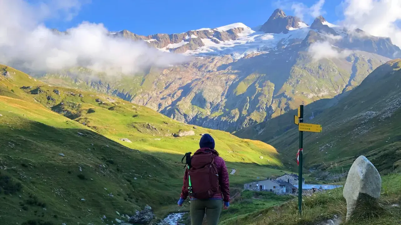
- The classic loop is roughly 166-180 km, with about 10,000-10,600 metres of ascent depending on the variants you choose.
- Most hikers need 10-11 days, and the daily effort is driven as much by descents as by distance.
- Mid-June to mid-September is the workable hiking window, with July and August bringing the best weather and the biggest crowds.
- Les Houches is the most common start and finish point, but other entries like Chamonix, Courmayeur, and Champex-Lac can fit different logistics.
- Booking early matters; the best refuges fill fast, and some huts still need direct contact rather than an online reservation.
- A lighter pack and a realistic training block will do more for your trip than chasing every scenic variant.
What the circuit around Mont Blanc actually covers
I think of this trek as a true alpine circuit, not a summit attempt. You are walking around the Mont Blanc massif, moving through three countries, sleeping in valleys and mountain huts, and climbing over passes that reward consistency more than speed. The route looks modest on a map until you stack the uphill and downhill days together, which is why it feels bigger on the body than the mileage suggests.
| Metric | Typical range | Why it matters |
|---|---|---|
| Distance | 166-180 km / 103-112 mi | Variants can shorten or extend the walk, so the headline number is only part of the story. |
| Total ascent | About 10,000-10,600 m | This is the real workload. The climbs and descents add up fast. |
| Typical duration | 10-11 days | Faster hikers can compress it, but that usually raises the daily strain. |
| Highest point | About 2,526-2,584 m | High enough to feel alpine, but not so high that altitude is the main concern. |
| Countries | France, Italy, Switzerland | Border changes are part of the appeal, and also part of the logistics. |
| Common trailhead | Les Houches near Chamonix | This is the most common practical start because it keeps transfers simple. |
| Best season | Mid-June to mid-September | Outside that window, snow and hut closures quickly change the character of the trip. |
The route’s popularity is part of its character too. You are not choosing a remote wilderness traverse here; you are choosing a well-loved alpine journey with enough infrastructure to make planning possible, but enough mountain reality to punish sloppy assumptions. That leads directly to the next decision, which is direction and route selection.
Why direction and route variants change the experience
I usually treat direction as a strategic choice, not a cosmetic one. The standard counterclockwise line is the default for a reason: it lines up with the most common itinerary patterns, the best-known trail logic, and the easiest planning flow for most hikers. Clockwise is still perfectly valid, but I would choose it deliberately, not by accident.
Counterclockwise vs clockwise
Counterclockwise is the familiar option. It usually feels easier to plan because more itineraries, hut sequences, and transport notes are built around it, and many hikers prefer moving with the mainstream flow. Clockwise can be attractive if you are trying to match a specific accommodation chain, avoid certain crowded segments early on, or simply want a different rhythm.
- Counterclockwise is the standard choice for first-time hikers because it is easier to research, book, and follow.
- Clockwise can work well if your dates or beds fit better in that direction, but it offers fewer ready-made plans.
- Either direction still gives you the same massif, so the real question is which version better matches your logistics and confidence.
Read Also: Fishermen's Trail Portugal - Is it Worth the Challenge?
Classic line vs high variants
This is where the trek gets interesting. The classic line is the safest assumption for a first itinerary, but the famous high variants are often what people remember most. Fenêtre d’Arpette and Col des Fours, for example, add a more exposed alpine feel and bigger views, but they also become more sensitive to snow, wind, and unstable weather. I would not force a high variant just because it looks more dramatic on paper.
Valley alternatives are sometimes dismissed too quickly, yet they are often the smartest move in poor conditions. If a steep section is wet, windy, or snow-covered, the lower option is not a consolation prize; it is the difference between a strong day and a bad one. That route flexibility matters even more once you look at the calendar and the booking window.
When to go and how far ahead to book
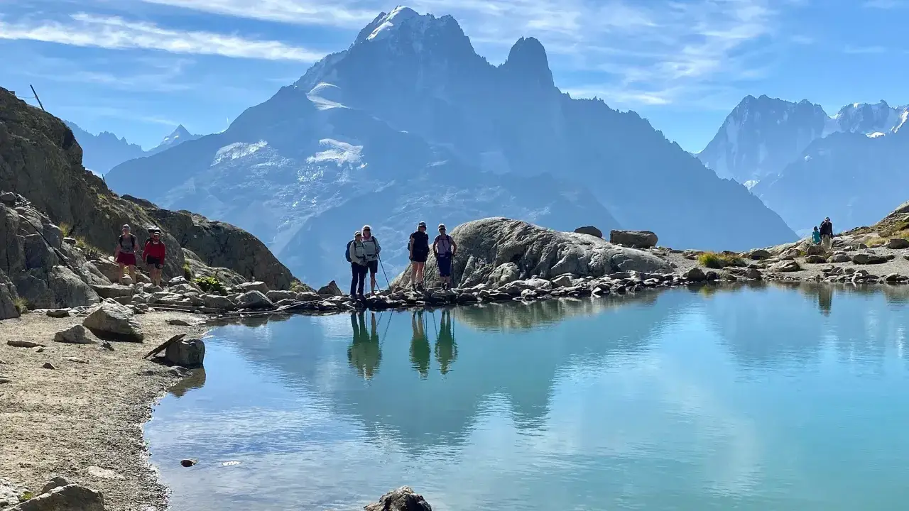
For a standard hiking trip, I would keep the season narrow. Mid-June to mid-September is the realistic window for most hikers, with the sweet spot sitting somewhere between stable weather and available refuges. July and August usually offer the most settled conditions, but they are also the busiest, hottest, and hardest months to book well.
| Window | What it offers | Main trade-off |
|---|---|---|
| Mid-June to late June | Quieter trail, fresh alpine scenery, more breathing room in some refuges | Lingering snow can still affect high passes |
| July to August | Best odds of stable summer weather and fully open services | Heavy trail traffic and the tightest booking pressure |
| Early to mid-September | Cooler temperatures, softer crowds, good light for scenery | Shorter days and the risk of huts closing earlier than expected |
The booking side matters just as much as the weather. For summer trips, I would not wait to see how I feel in a few months. The official booking system opens reservations well ahead of the season, and not every hut is handled the same way. Some can be reserved online, while others still require direct contact, which means a good plan needs backup options from the beginning.
My rule is simple: if your dates are fixed, build the itinerary early and assume popular nights will disappear first. If your dates are flexible, use that flexibility to stay out of the most crowded part of the season. That is the cleanest bridge into the question of difficulty, because the calendar and the trail effort are more connected than most hikers expect.
How hard it feels once you are on the trail
What surprises first-time hikers is not the length of the route. It is the repetition. A day of 15-20 km on the TMB can still demand 5-9 hours once you add 700-1,000 metres of climbing, a similar amount of descending, and the natural slowdown that happens on rocky alpine terrain. The climbs are honest, but the descents are often the part that catches people out.
I would want to be comfortable with all of the following before I started:
- Back-to-back hikes of 4-6 hours on hilly terrain
- At least one day with 700-1,000 metres of climbing
- Steady footing on switchbacks, loose rock, and uneven trail surfaces
- Walking downhill when your legs are already tired
- Carrying a pack that feels normal after several hours, not just at the trailhead
That is why I do not think of the trek as “moderate” in the casual sense. It is moderate only if you already have a base of mountain fitness. For everyone else, it is a meaningful endurance project. A simple 8-12 week training block can change the experience dramatically, especially if it includes long walks with a loaded pack and downhill practice, not just cardio in the gym. Once your legs are ready, the next decision is the style of trip you want to buy into.
Which trip style fits your budget and experience
I do not think the best version is the cheapest one. I think it is the version that keeps you calm on day six, when the novelty has worn off and the logistics start to matter. For some hikers that means full independence. For others it means paying for support and using that money to save energy.
| Style | Best for | What it solves | Trade-off |
|---|---|---|---|
| Self-guided hut-to-hut | Experienced hikers who like freedom | Lower cost and more control over the pace | You handle the booking, routing, and backup planning yourself |
| Guided group | First-timers and hikers who want structure | Route handling, pacing, and on-the-ground support | Higher cost and less freedom to change the daily plan |
| Semi-supported with luggage transfer | People who want lighter packs and easier recovery | Less strain on shoulders and knees | Not every refuge sequence or variant works cleanly with this setup |
If you are coming from the United States for a once-in-a-lifetime trip, I would lean toward whichever format removes the most friction. A guided or semi-guided trek can be a very rational purchase if it protects sleep, simplifies logistics, and keeps you from spending your evenings wrestling with reservations. The trail rewards attention, not heroics.
How I would budget the trip from the US
I prefer to budget the hiking trip itself in euros and keep transatlantic airfare separate, because flights move too much to be useful in a trail budget. For most hikers, Geneva is the cleanest gateway, and Les Houches sits roughly 93 km away, which makes the first transfer simple if you arrive the day before the trek starts. I would also budget one buffer night at the beginning and one at the end, because that small cushion usually improves the whole trip.
| Budget band | What it usually covers | Best fit |
|---|---|---|
| €80-€140 per day | Dorm beds, simple meals, basic local transport | Independent hikers keeping the route minimal and efficient |
| €150-€250 per day | Private rooms or better refuges, some flexibility in transport | Comfort-focused self-guided trips |
| €250-€450+ per day | Guided or semi-guided itineraries, more support, less planning stress | First-timers, time-poor travelers, and anyone who values convenience |
These are planning ranges, not fixed prices, and peak summer weeks can push them higher. I also factor in snacks, a couple of coffees, occasional lunch stops, and a small contingency fund for weather-related changes or transport tweaks. If your route includes Courmayeur, remember that the Mont Blanc tunnel can add time even when the map looks compact. Once the money side is clear, packing becomes the next place where smart decisions save energy.
How to prepare without overpacking
On this route, every extra gram gets multiplied by the climb and the descent. I would rather carry a few items I trust than a full pack of “just in case” gear that looks reassuring in a hotel room and annoying on a steep path. The goal is not to be minimal for its own sake. The goal is to stay fresh enough to enjoy the next day.
- A real waterproof shell that you trust in mountain rain
- One warm mid-layer and one spare top for changing conditions
- Broken-in hiking shoes or boots, not brand-new ones
- Trekking poles to reduce strain on long descents
- Blister care and basic first aid for small problems before they become big ones
- Sun protection, including a hat and sunglasses, because alpine sun is not gentle
- Headlamp, power bank, ID, and some cash in euros
- A refillable bottle or reservoir for regular hydration between stops
For a hut-to-hut trek, I would try to keep the pack around 6-8 kg before water. If it creeps much higher, the route starts taking more than it should from your legs and shoulders. Training, packing, and weather awareness solve most of the early pain points, which is why the usual mistakes are so easy to avoid once you know what to watch for.
The mistakes that cost people energy and time
- Booking only the obvious nights. If you leave no flexibility between full refuges, one missing bed can unravel the whole week.
- Underestimating descents. The climbs get the attention, but the downhill sections usually hit the legs harder.
- Starting too late each morning. On an alpine route, a late start compresses your margin for weather, rests, and route changes.
- Choosing every high variant. Not every scenic detour is a good idea on a windy or snowy afternoon.
- Carrying a town-walk pack. The difference between 5 kg and 9 kg becomes very obvious by day four.
- Ignoring hut and transport rules. Some stays need direct contact, and some route changes are easier than others.
I think the best itineraries respect those limits instead of pretending they do not exist. That is also why the finish of the trek should feel flexible, not rigid.
Leave room for weather, not just mileage
The strongest TMB plans are usually the least brittle. I like to leave one easier day after a major pass, one weather alternative in my pocket, and one buffer night at the start or end of the trip. That sounds conservative on paper, but on the trail it often creates the exact opposite feeling: less stress, better sleep, and more time to enjoy the places that make the circuit special.
If I were planning this trek now, I would lock the beds early, keep the pack light, and treat the route as an alpine journey rather than a race against the map. The difference is subtle until you are out there, and then it is everything.