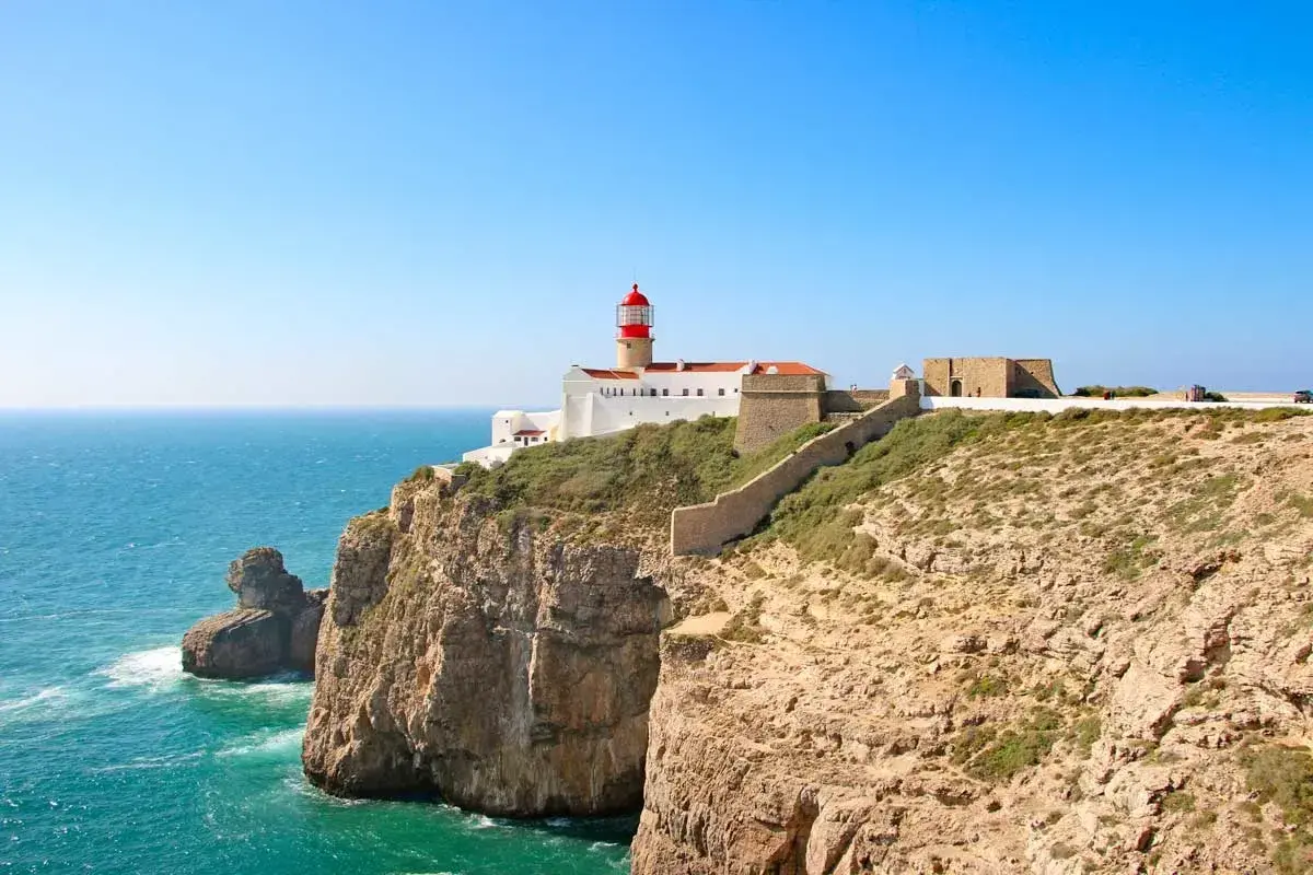
If you are deciding whether to do the full route or only a section, I would treat this as a planning guide first and a travel inspiration piece second. The coastline is beautiful, but the difference between a good trip and a frustrating one usually comes down to timing, pace, and logistics.
The essentials before you commit to the walk
- Length: about 226.5 km across 13 official stages.
- Terrain: expect long sandy stretches, exposed cliffs, wind, and limited shade.
- Season: the safest planning window is September to June, with spring and early autumn usually the most comfortable.
- Logistics: no wild camping; book lodging early and use luggage transfer if you want lighter days.
- Flexibility: the trail can be walked in either direction, so transport and accommodation matter more than a fixed starting point.
- Reality check: the longest official stage tops out at 22.5 km, but sand can make it feel longer.
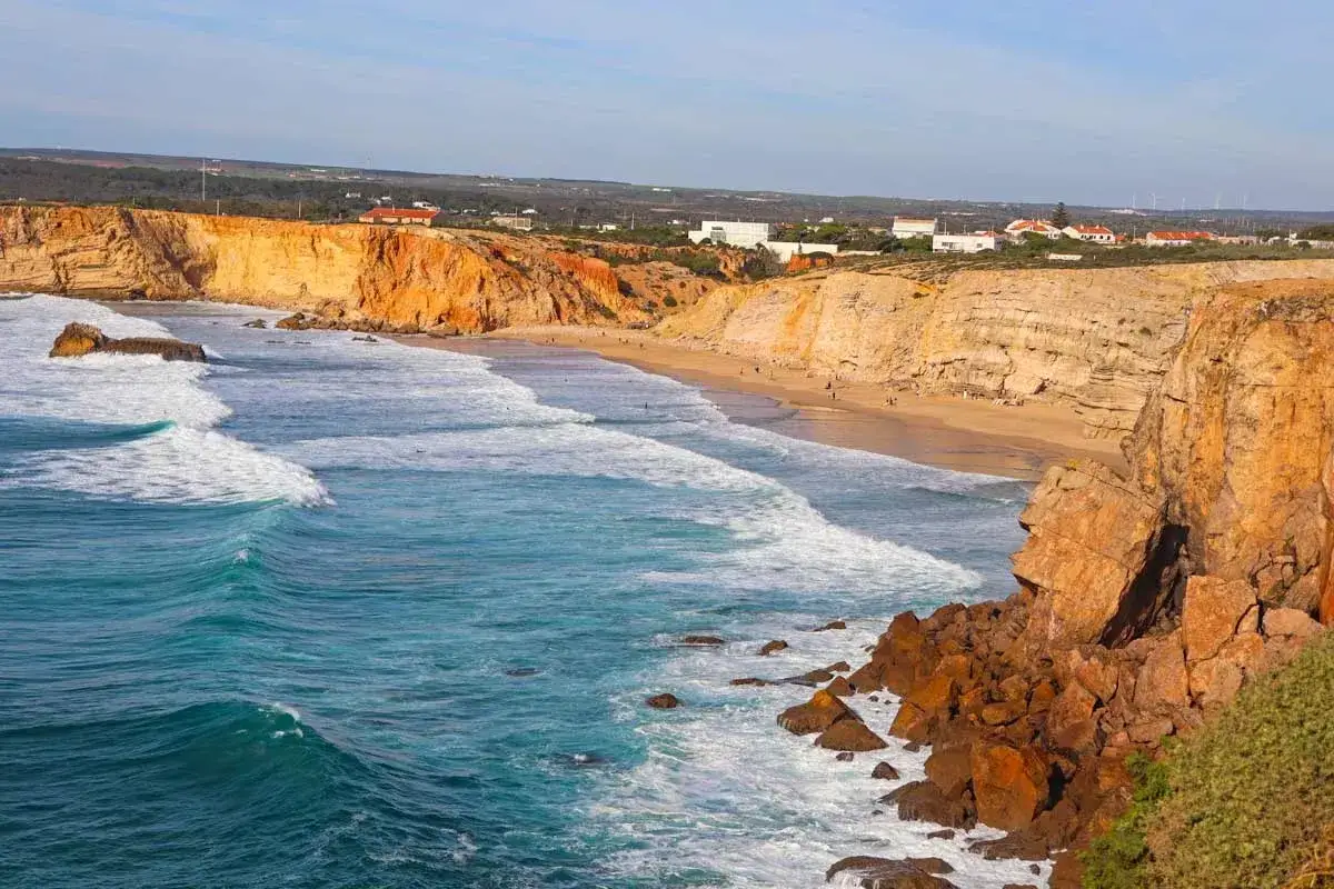
What the Fishermen’s Trail actually is
In practical terms, this is the coastal branch of the Rota Vicentina network, running along southwest Portugal’s Atlantic edge from the São Torpes/Porto Covo area toward Lagos. The official route is about 226.5 km and is divided into 13 one-day stages; it can be walked in either direction, although many hikers still think of it as a north-to-south journey.
What makes it different from a generic coastal path is that the route follows the old tracks locals used to reach beaches and fishing grounds. It is a trail for pedestrians only, which matters because the narrow cliff paths, dune crossings, and soft sand are not built for fast movement or mixed traffic.
I like that distinction because it keeps expectations honest. This is not a “collect the views and move on” walk; it is a proper footpath shaped by terrain, weather, and rhythm. Once you see it that way, the planning choices start to make much more sense.
The next question is obvious: how hard does that actually feel once you start walking stage after stage?
Why the trail feels tougher than the postcard photos suggest
The scenery is dramatic, but the walking is not a casual promenade. The official trail notes that roughly 60% to 70% of the route is sandy, and sand changes the pace far more than elevation does: a 20 km stage can feel much longer when you are repeatedly sinking into soft ground or fighting a headwind.
I would also treat the cliffs as a real factor, not just a visual bonus. The route is not recommended for people with vertigo or a strong fear of heights, and erosion is part of the landscape, which means the edge is dynamic rather than decorative. On exposed days, the combination of sun, wind, and lack of shade can be more draining than the distance itself.
| Feature | What it means on the trail |
|---|---|
| Deep sand | Slower pace, extra calf work, and higher energy use. |
| Cliffs and exposure | Big views, but less comfort if you dislike heights or loose edges. |
| Wind and sun | Heat and dehydration can build up fast because shade is limited. |
| Waymarking | Clear enough for self-guided hiking, but you still need to pay attention. |
| Foot-only access | Great for walkers, useless if you were hoping to cycle or speed through it. |
That mix is exactly why the trail is memorable. It rewards steady walkers more than ambitious speed-hikers, and that should influence how you choose your stages. The next decision is how much of the coastline you actually want to commit to.
How to choose a route plan that fits your time
If I were planning from scratch, I would think in terms of coastline experience rather than distance alone. The trail works best when the daily walking feels sustainable, because soft sand and exposure punish overambitious schedules more quickly than many people expect.
| Plan | Best for | Trade-off |
|---|---|---|
| Full 13-stage trek | Hikers who want the complete Atlantic crossing and enough time for all stages without rushing | More logistics, more booking pressure, and more cumulative fatigue |
| Multi-day section | Travelers who want the classic scenery without committing to every stage | You miss some of the quieter transitions between villages |
| Long-weekend sampling | People combining hiking with a broader Portugal trip | Needs careful transport planning and is best treated as a taste of the route |
| Single-stage day hike | Anyone who wants the terrain and views without changing accommodation | You get a snapshot, not the full coastal rhythm |
The northern stretches around Porto Covo, Vila Nova de Milfontes, Almograve, and Zambujeira do Mar usually give first-time hikers the clearest feel for the route’s identity. The Algarve end near Sagres and Lagos is useful when you want easier access, more services, and the option to fold hiking into a broader holiday.
The direction is less important than many people assume. Because the trail can be walked both ways, I would let accommodation availability, airport transfers, and your own tolerance for headwinds decide the direction instead of forcing an arbitrary southbound plan.
With the route shape decided, the next variable is the one that changes the walk most dramatically: the season.
When to go for the best walking conditions
The official hiking window runs from September to June, and that guidance is sensible. The region gets hot in summer, and long walks in July and August are much less attractive because temperatures can rise above 30°C, accommodation gets busier, and service flexibility drops.
| Period | What it feels like | My take |
|---|---|---|
| March to May | Mild temperatures, greener landscapes, spring flowers | My preferred balance of comfort and scenery |
| September to October | Warm but usually manageable, still good beach weather | Excellent if you want settled weather without peak summer pressure |
| November to February | Quieter, cooler, more wind and rain risk | Doable if you are flexible and properly equipped |
| July to August | Hot, exposed, and more crowded | I would avoid full-stage hiking unless you are very heat tolerant |
There is a practical reason I keep returning to spring and early autumn: they reduce the number of trade-offs. You are still dealing with sand and exposure, but you are not stacking them on top of peak heat and overloaded services. That makes the route far more enjoyable, especially if you are travelling from the United States and want a trip that feels active rather than punishing.
Once you pick the right window, the trip becomes much easier to pack and book.
What to pack and how to handle logistics
I would keep the pack lighter than on a mountain trek, but not minimalist to the point of regret. The trail is exposed enough that the basics matter more than extra gear.
- Footwear with grip - sand, loose gravel, and cliff-edge paths punish slick soles.
- At least 1.5 to 2.5 liters of water capacity - shade is inconsistent, and long sections feel hotter than the thermometer suggests.
- Sun protection - hat, sunglasses, and high-SPF sunscreen are not optional on exposed stages.
- Offline navigation - the route is well signposted, but GPS tracks are worth carrying for detours and reassurance.
- Light wind shell - the Atlantic breeze can be cooling one hour and irritating the next.
- Booking buffer - there are more than 100 partner accommodations, but you should still reserve early in the more popular months.
Two logistics details change the experience more than most first-timers expect. First, wild camping is not allowed, so this is a proper point-to-point walking route rather than a free-form bivouac adventure. Second, luggage transfer and passenger transport are available through partner services, which makes the trail much more accessible if you want to walk with a day pack instead of carrying everything yourself.
The walking trails are free to use, so your real costs are lodging, transport, food, and any luggage service you choose. Rota Vicentina also provides maps, GPX tracks, and distance tables, and I would treat those as part of the planning kit rather than optional extras.
With the logistics sorted, the only real remaining question is which stretches actually deserve your time if you cannot walk the whole coast.
Which stretches are worth prioritizing if you only have a few days
If I had to compress the trail into a short trip, I would choose linked sections instead of random single days. That keeps the coastal rhythm intact, which is the real strength of the route.
| Section | Why it stands out | Who should choose it |
|---|---|---|
| Porto Covo to Vila Nova de Milfontes | Classic opening coastline, wide views, and an immediate sense of why the trail is famous | First-time hikers and anyone who wants the most representative start |
| Almograve to Zambujeira do Mar | Long open stretches and a stronger sense of solitude | Hikers who like a rawer, quieter feel |
| Odeceixe and the nearby coast | Strong scenery plus useful village logistics | Travelers who need a practical halfway base |
| Western Algarve finish | More transport options and an easy handoff into a larger Portugal trip | People who want to pair hiking with time in Sagres or Lagos |
My honest advice is not to chase the “best” stage as if one section will somehow define the entire walk. The stronger approach is to pick two or three adjacent stages, book around them, and let the route unfold at a pace that leaves room for lunch, swims, and recovery.
The small choices that make the walk feel lighter
The Fishermen’s Trail rewards restraint. Start early, keep your daily distances realistic, and do not let a beautiful weather forecast tempt you into overpacking or overextending a stage just because it looks short on paper. Sand, heat, and wind have a way of making otherwise ordinary distances feel more serious.
If I were planning it again, I would choose accommodation before I chose pace, and I would choose pace before I chose sightseeing extras. That order gives you the best chance of enjoying the coast for what it is: a long Atlantic walk that works best when you let it be steady, exposed, and unhurried.